


Metrikler
Yayın
26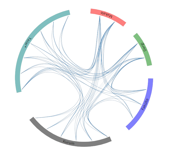
Açık Erişim
5
BM Sürdürülebilir Kalkınma Amaçları


Eğitim Bilgileri
2013 - 2019
2013 - 2019Doktora
Erciyes Üniversitesi, Fen Bilimleri Enstitüsü, Harita Mühendisliği (Dr), Türkiye
2010 - 2013
2010 - 2013Yüksek Lisans
Erciyes Üniversitesi, Fen Bilimleri Enstitüsü, Harita Mühendisliği (Yl) (Tezli), Türkiye
2006 - 2010
2006 - 2010Lisans
Erciyes Üniversitesi, Mühendislik Fakültesi, Harita Mühendisliği Bölümü, Türkiye
Yaptığı Tezler
2019
2019Doktora
Uzaktan algılamayla geçirimsiz yüzeylerin analizi
Erciyes Üniversitesi, Fen Bilimleri Enstitüsü, Harita Mühendisliği (Dr)
2013
2013Yüksek Lisans
Sultan Sazlığı Milli Parkı ve Ramsar Alanı Kıyı Değişiminin Uydu Görüntü Analizleriyle İncelenmesi
Erciyes Üniversitesi, Fen Bilimleri Enstitüsü, Harita Mühendisliği (Yl) (Tezli)
Yabancı Diller
B1 Orta
B1 Ortaİngilizce
Sertifika, Kurs ve Eğitimler
2018
2018İHA-1 Sınıfı İnsansız Hava Aracı Kullanma Sertifikası
Mesleki Kurs
Erciyes Üniversitesi Sürekli Eğitim Merkezi (ERSEM)
2010
2010İngilizce Eğitimi (Öğretim Üyesi Yetiştirme Programı Bünyesinde)
Yabancı Dil
Ankara Üniversitesi Yabancı Diller Meslek Yüksek Okulu
2009
2009Kişisel Motivasyonu Sağlama ve İş Hayatının Renklerini Etkili Kullanma
Eğitim Yönetimi ve Planlama
Indus Danışmanlık
2008
2008NETCAD 5.0 GIS Coğrafi Bilgi Sistemleri Sertifikası
Mesleki Kurs
NETCAD
Araştırma Alanları
Harita Mühendisliği-Geomatik
Uzaktan Algılama
Görüntü İşleme
Akademik Faaliyetlere Dayalı Araştırma Alanları
Avesis Araştırma Alanları
WoS Araştırma Alanları
Scopus Araştırma Alanları
Akademik Ünvanlar / Görevler
2022 - Devam Ediyor
2022 - Devam EdiyorAraştırma Görevlisi Dr.
Uşak Üniversitesi, MÜHENDİSLİK VE DOĞA BİLİMLERİ FAKÜLTESİ, İnşaat Mühendisliği Bölümü
2022 - 2022
2022 - 2022Araştırma Görevlisi Dr.
Uşak Üniversitesi, MİMARLIK VE TASARIM FAKÜLTESİ, ŞEHİR VE BÖLGE PLANLAMA BÖLÜMÜ
2019 - 2022
2019 - 2022Araştırma Görevlisi Dr.
Uşak Üniversitesi, MÜHENDİSLİK VE DOĞA BİLİMLERİ FAKÜLTESİ, HARİTA MÜHENDİSLİĞİ BÖLÜMÜ
2013 - 2019
2013 - 2019Araştırma Görevlisi
Erciyes Üniversitesi, Fen Bilimleri Enstitüsü, Harita Mühendisliği (Dr)
2011 - 2013
2011 - 2013Araştırma Görevlisi
Erciyes Üniversitesi, Fen Bilimleri Enstitüsü, Harita Mühendisliği (Yl) (Tezli)
Verdiği Dersler
Lisans
Lisans
Proje 2
Jeodezi 1
Ölçme Bilgisi 1
Ölçme Bilgisi 3
Taşınmaz Değerleme
Karayolu Projesi
Trigonometri
Mühendislik Ölçmeleri
Taşınmaz Mal Hukuku
Jeodezi 1
Proje I (N.Ö.)
Sosyal Sorumluluk Projesi I (İ.Ö.)
Coğrafi Bilgi Sistemleri Giriş (İ.Ö.)
Coğrafi Bilgi Sistemleri Giriş (N.Ö.)
Sosyal Sorumluluk Projesi I (N.Ö.)
Lidar Teknikleri (N.Ö.)
Makaleler
Tümü (8)
SCI-E, SSCI, AHCI (4)
SCI-E, SSCI, AHCI, ESCI (4)
Scopus (6)
TRDizin (3)
Diğer Yayınlar (1)
2025
20251. Enhancing Snow Detection through Deep Learning: Evaluating CNN Performance Against Machine Learning and Unsupervised Classification Methods
Kesikoğlu M. H.
WATER RESOURCES MANAGEMENT
, cilt.39, sa.12, ss.6053-6071, 2025 (SCI-Expanded, Scopus)


2025
20252. Tracking seasonal coastal dynamics of Ağyatan wetland using object-based Classification and Regression Tree
Kesikoğlu M. H., Kaynak T.
Niğde Ömer Halisdemir University Journal of Engineering Sciences
, sa.Volume 14, Issue 1, ss.308-317, 2025 (TRDizin)
2025
20253. Comparative analysis of R/SWIR, NIR/SWIR, and NDSI classification methods for determination of snow cover change on Erciyes Mountain, Türkiye using Landsat satellite images
Kesikoğlu M. H.
Research on Engineering Structures and Materials
, cilt.11, sa.4, ss.1653-1665, 2025 (Scopus, TRDizin)
2024
20244. Evaluating spatial resolution enhancement on impervious surface detection using support vector machine
Kesikoğlu M. H., ,
Research & Design
, cilt.1, sa.1, ss.33-42, 2024 (Hakemli Dergi)
2021
20215. The impact of impervious surface, vegetation, and soil areas on land surface temperatures in a semi-arid region using Landsat satellite images enriched with Ndaisi method data
Kesikoğlu M. H., Özkan C., Kaynak T.
Environmental Monitoring and Assessment
, cilt.193, sa.3, 2021 (SCI-Expanded, Scopus)


2020
20206. THE IDENTIFICATION OF SEASONAL COASTLINE CHANGES FROM LANDSAT 8 SATELLITE DATA USING ARTIFICIAL NEURAL NETWORKS AND K-NEAREST NEIGHBOR
Kesikoğlu M. H., Çiçekli S. Y., Kaynak T.
Turkish Journal of Engineering
, cilt.4, sa.1, ss.47-56, 2020 (Scopus, TRDizin)
2019
20197. Performance of ANN, SVM and MLH techniques for land use/cover change detection at Sultan Marshes wetland, Turkey
KESİKOĞLU M. H., ATASEVER Ü. H., DADAŞER ÇELİK F., ÖZKAN C.
Water Science and Technology
, cilt.80, sa.3, ss.466-477, 2019 (SCI-Expanded, Scopus)
2016
20168. A new artificial intelligence optimization method for PCA based unsupervised change detection of remote sensing image data
ATASEVER Ü. H., KESİKOĞLU M. H., ÖZKAN C.
Neural Network World
, cilt.26, sa.2, ss.141-154, 2016 (SCI-Expanded, Scopus)
Hakemli Bilimsel Toplantılarda Yayımlanmış Bildiriler
2022
20221. The effect of pixel-based classification methods to determine the impervious surface areas on pan-sharpened satellite imagery
KESİKOĞLU M. H.
4th International Conference on Applied Engineering and Natural Sciences, Konya, Türkiye, 10 - 13 Kasım 2022, (Özet Bildiri)
2022
20222. The effect of a pan-sharpened satellite image on the determination of impervious surface areas
KESİKOĞLU M. H.
2nd International Conference on Engineering and Applied Natural Sciences, Konya, Türkiye, 15 - 18 Ekim 2022, (Özet Bildiri)
2022
20223. Determining snow cover change using remote sensing images on Erciyes mountain
KESİKOĞLU M. H.
1st International Conference on Engineering and Applied Natural Sciences, Konya, Türkiye, 10 - 13 Mayıs 2022, (Özet Bildiri)
2018
20184. Determination Of Coastline Changes at Kozan Dam Lake By Using Artificial Neural Networks Method
KAYNAK T., ÇİÇEKLİ S. Y., KESİKOĞLU M. H.
International Conference on Advanced Technologies, Computer Engineering and Science (ICATCES 2018), Karabük, Türkiye, 11 - 13 Mayıs 2018, (Tam Metin Bildiri)
2018
20185. Comparison of Pixel Based And Object Based Classification Methods on Wetland Areas: Example of Aslantaş Dam Lake
KESİKOĞLU M. H., ÇİÇEKLİ S. Y., KAYNAK T.
International Conference on Advanced Technologies, Computer Engineering and Science (ICATCES), Karabük, Türkiye, 11 - 13 Mayıs 2018, (Tam Metin Bildiri)
2018
20186. A Brief Review on Object Oriented Image Classification Methods for Information Extraction from Satellite and Aerial Images on Land Use/Cover Applications
KESİKOĞLU M. H., ÇİÇEKLİ S. Y., KAYNAK T.
Ist International Symposium on Innovative Approaches in Scientific Studies (ISAS 2018), Antalya, Türkiye, 11 - 13 Nisan 2018, (Özet Bildiri)
2018
20187. Determination of Seasonal Coastal Boundary Change of Ağyatan Natural Site Area
ÇİÇEKLİ S. Y., KAYNAK T., KESİKOĞLU M. H.
Ist International Symposium on Innovative Approaches in Scientific Studies (ISAS 2018), Antalya, Türkiye, 11 - 13 Nisan 2018, (Özet Bildiri)
2018
20188. Uydu görüntüleri yardımıyla kıyısal alan tespiti uygulamalarındaki son gelişmeler
KESİKOĞLU M. H., KAYNAK T., ÇİÇEKLİ S. Y.
Ist International Symposium on Innovative Approaches in Scientific Studies (ISAS 2018), Antalya, Türkiye, 11 - 13 Nisan 2018, (Özet Bildiri)
2018
20189. The Determination of Coastline Change Using Support VectorMachine in Berdan Dam Lake, Turkey
KAYNAK T., ÇİÇEKLİ S. Y., KESİKOĞLU M. H., ÖZKAN C.
2nd International Conference on Engineering Technology and Innovation (ICETI), Budapest, Macaristan, 7 - 11 Mart 2018, (Tam Metin Bildiri)
2017
201710. The determination of coastline changes using artificial neural networks in Yamula Dam Lake, Turkey
KESİKOĞLU M. H., ÇİÇEKLİ S. Y., KAYNAK T., ÖZKAN C.
The 8thInternationalConference onInformationTechnology, Amman, Ürdün, 17 - 18 Mayıs 2017, (Tam Metin Bildiri)
2016
201611. Daire Tipi Konutların Değerlemesinde Yapay Sinir Ağlarının Kullanımı
Demirel S. B., Reyhan O., ATASEVER Ü. H., KESİKOĞLU M. H.
VI. Uzaktan Algılama ve CBS Sempozyumu, Adana, Türkiye, 5 - 07 Ekim 2016, (Tam Metin Bildiri)
2016
201612. The usage of rusboost boosting method for classification of impervious surfaces
KESİKOĞLU M. H., ATASEVER Ü. H., ÖZKAN C., BEŞDOK E.
XXIII ISPRS Congress 2016, Prag, CEK CUM., 12 - 19 Temmuz 2016, (Tam Metin Bildiri)
2015
201513. İnsansız Hava Araçları ile Sayısal Arazi Modeli Üretimi
KARKINLI A. E., KESİKOĞLU A., KESİKOĞLU M. H., ATASEVER Ü. H., ÖZKAN C., ÇİVİCİOĞLU BEŞDOK P., et al.
TUFUAB VIII. Teknik Sempozyumu, Türkiye, 21 - 23 Mayıs 2015, (Tam Metin Bildiri)
2015
201514. Sultan Sazlığı Milli Parkı Ramsar Bölgesi Arazi Örtüsünün Belirlenmesi Boosting Sınıflandırma Yaklaşımı
KESİKOĞLU M. H., ATASEVER Ü. H., KESİKOĞLU A., KARKINLI A. E., ÖZKAN C., BEŞDOK E.
TÜRKİYE ULUSAL FOTOGRAMETRİ Ve UZAKTAN ALGILAMA BİRLİĞİ (TUFUAB) VIII.SEMPOZYUMU, Türkiye, 21 - 23 Mayıs 2015, (Tam Metin Bildiri)
2013
201315. EVAMAPPER A NOVEL MATLAB TOOLBOX FOR EVAPOTRANSPIRATION MAPPING
ATASEVER Ü. H., KESİKOĞLU M. H., ÖZKAN C.
ISPRS Conference on “Serving Society with Geoinformatics”, Antalya, TURKEY, Antalya, Türkiye, 11 - 17 Kasım 2013, (Tam Metin Bildiri)
2013
201316. UNSUPERVISED CHANGE DETECTION IN SATELLITE IMAGES USING FUZZY C MEANS CLUSTERING AND PRINCIPAL COMPONENT ANALYSIS
KESİKOĞLU M. H., ATASEVER Ü. H., ÖZKAN C.
ISPRS Conference on “Serving Society with Geoinformatics”, Antalya, TURKEY, Antalya, Türkiye, 11 - 17 Kasım 2013, (Tam Metin Bildiri)
2013
201317. Uzaktan Algılamada Kontrolsüz Değişim Belirleme
KESİKOĞLU M. H., ATASEVER Ü. H., ÖZKAN C.
14. Türkiye Harita Bilimsel ve Teknik Kurultayı, Ankara, Türkiye, 14 - 17 Mayıs 2013, (Tam Metin Bildiri)
2012
201218. The Pros and Cons of Building Licensed Offices of Surveying and Cadastre in Turkey
KESİKOĞLU M. H., ÇETE M.
FIG Working Week 2012 / Knowing to manage the territory, protect the environment, evaluate the cultural heritage, Roma, İtalya, 6 - 10 Mayıs 2012, (Tam Metin Bildiri)
Desteklenen Projeler
2014 - 2015
2014 - 2015Landsat 8 Verileri Kullanarak Diferansiyel Arama Algoritması Ile Modifiye Edilmiş Yeni Bir Sebal Yaklaşımı Tasarımı
TÜBİTAK Projesi , 3501 - Ulusal Genç Araştırmacı Kariyer Geliştirme Programı
2013 - 2014
2013 - 2014Uzaktan Algılamada Diferansiyel Arama Algoritması DS Tabanlı Yeni Bir Kontrolsüz Değişim Belirleme Yaklaşımı
Yükseköğretim Kurumları Destekli Proje , BAP Araştırma Projesi
Kesikoğlu M. H., Atasever Ü. H.
2013 - 2014
2013 - 2014
Sultan Sazlığı Milli Parkı ve Ramsar Alanı Kıyı Değişiminin Uydu Görüntü Analizleriyle İncelenmesi
Yükseköğretim Kurumları Destekli Proje , BAP Araştırma Projesi
Kesikoğlu M. H., Özkan C.
Bilimsel Yayınlarda Hakemlikler
Ağustos 2017
Ağustos 2017EUROPEAN JOURNAL OF REMOTE SENSING
SCI Kapsamındaki Dergi
Burslar
2015 - 2017
2015 - 2017